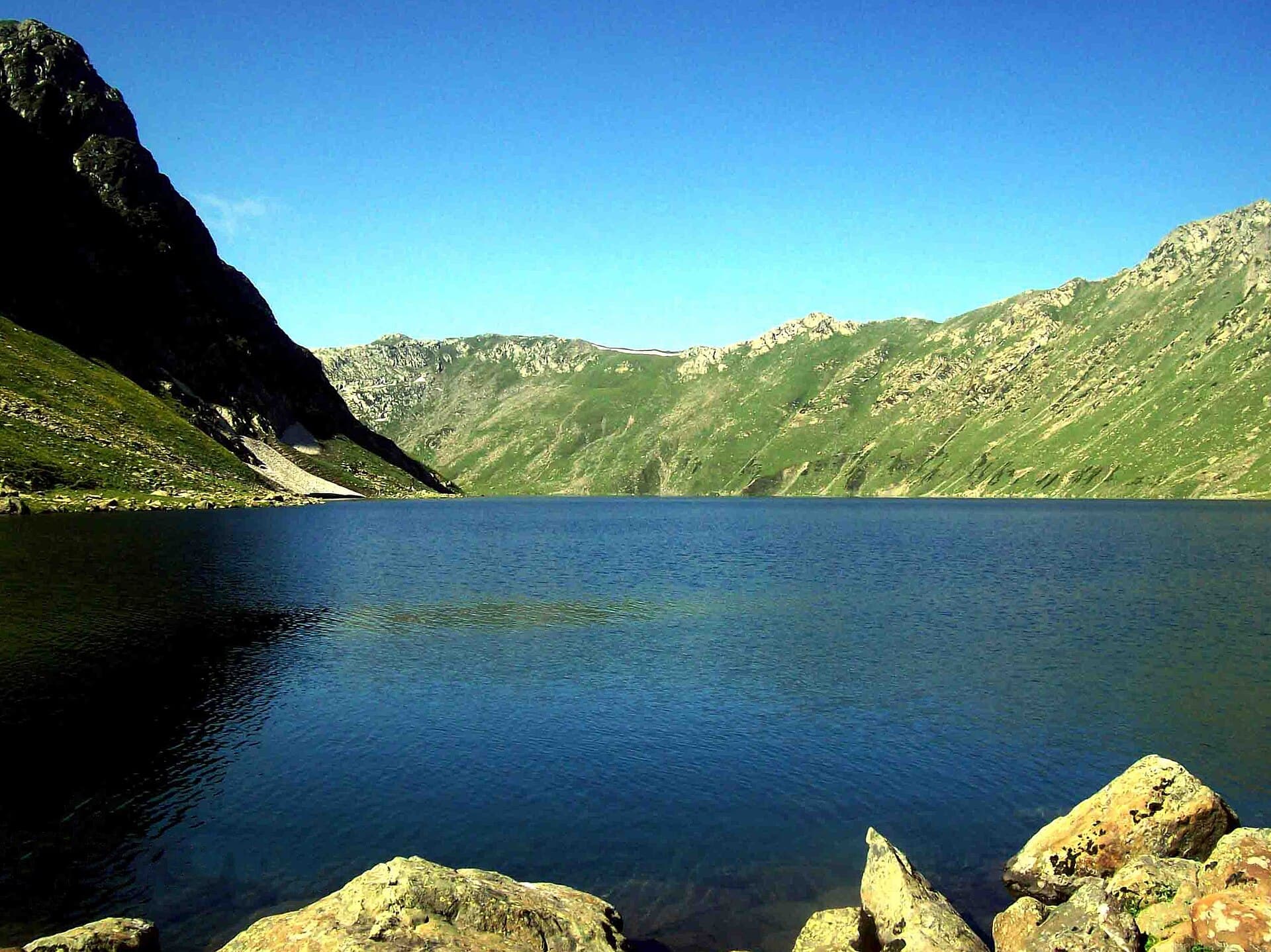
Tarsar Marsar
Twin lakes, separated by one high ridge.
Photo: Irfanaru / Wikimedia Commons (CC BY-SA 3.0)
Challenging
Difficulty
60 km
Distance
7D / 6N
Duration
4,000 m / 13,123 ft
Peak Altitude
Summer
Best Season
Why This Trek
Tarsar Marsar
Tarsar and Marsar are often described as twin lakes, but most people who reach one never see the other on the same trip - the ridge between them is the real test of the route, and it doesn't always cooperate. We like that honesty: this isn't a trek with a guaranteed photo of both lakes in one frame. We want to walk it ourselves, including on a day the ridge doesn't cooperate, before we put a confirmed itinerary in front of anyone.
Before You Book
- Forest access may require a valid permit.
- Authorised guide support may be mandatory.
- Departure depends on current route availability.
- Weather and wildlife conditions may affect access.
- Route and timings can change for safety reasons.
- Camping is only offered where currently permitted.
- Government ID may be required for permit registration.
- Final confirmation is issued only after operational verification.
The Trail
The route runs from Aru Valley near Pahalgam through Lidderwat's forest and meadow campsites, climbing to Tarsar Lake before the high ridge crossing toward Marsar - a crossing that depends on snow and weather conditions and is sometimes not attempted at all. This trek sits in Anantnag district's Lidder Valley, and the itinerary below reflects the commonly published route rather than one we've confirmed by walking it ourselves.
- Two alpine lakes - Tarsar and Marsar - separated by a single high ridge, rarely visited together
- Lidderwat's pine forest and open meadow campsites along the Lidder river
- A quieter, less-trafficked alternative to the Kashmir Great Lakes route
- The Tarsar-Marsar ridge crossing itself, weather permitting
Itinerary
- 1
Pahalgam to Aru, trek to Lidderwat
Drive to Aru Valley, then trek through pine forest along the Lidder river to camp at Lidderwat.
11 km
- 2
Lidderwat to Shekwas
A shorter day through meadow and forest, gaining altitude gradually toward the next camp.
8 km
- 3
Shekwas to Tarsar Lake
Climb out of the treeline to camp beside Tarsar Lake, the first of the two alpine lakes on the route.
9 km · +550 m
- 4
Tarsar to Marsar via the connecting ridge (weather-dependent)
The trek's high point - a ridge crossing toward Marsar Lake, attempted only if conditions allow, before descending to camp at Homwas.
12 km · +400 m
- 5
Homwas to Aru
A long descent day back through forest to the roadhead at Aru.
13 km
- 6
Aru to Pahalgam / Srinagar
Transfer out of the valley - trek proper ends here.
- 7
Contingency / buffer day
Held in reserve for weather delays, particularly around the Tarsar-Marsar ridge crossing - not used unless conditions require it.
Who Is This Trek For?
Fitness level required: high. Group size runs 6–12 people. Age range: 14–55 years.
This is a high-altitude, multi-day trek with a demanding ridge crossing between the two lakes. Participants above 45 years, and anyone with a pre-existing heart, lung or blood-pressure condition, will need to share a valid medical fitness certificate before we can confirm a spot.
Inclusions & Exclusions
- Trek permit and registration coordination, once confirmed
- Authorised local trek guide
- Trek leader and on-trail first-aid support
- Tented accommodation and vegetarian trail meals for the duration of the trek
- Travel to and from Srinagar or Pahalgam
- Personal trekking gear (shoes, backpack, sleeping bag, rain cover, etc.)
- Any stay before or after the trek
- Medical certificate fee, where applicable
What to Carry
- Sturdy trekking shoes worn in well before the trek, not new out of the box
- Warm layers for near-freezing camp nights, even in July-August
- Rain shell / poncho and a pack cover
- Sun protection - high-altitude UV is stronger than it feels
- Personal medication and a copy of any medical fitness certificate
- Valid photo ID (Aadhaar or passport) - carried at all times
Safety
- Trek leader carries a first-aid kit and satellite communication device - network coverage is patchy to absent for most of the route
- The Tarsar-Marsar ridge crossing is attempted only when conditions genuinely allow it - the trek leader's call, not the schedule's
- Weather-based rescheduling, and any local authority guidance on access, takes priority over the published itinerary
- Group pace is set by the slowest member, not the fastest
Permits
The trail runs through Anantnag district's Lidder Valley, where registration with local tourism and district authorities is standard practice for multi-day treks. We haven't yet confirmed the current permit process, group registration requirements, or whether any section is time- or access-restricted - that will be verified before this trek opens for booking.
Cancellation Policy
A ₹1,000 Booking Advance secures your booking request. Final confirmation is issued only after operational and permit verification. The advance is non-refundable and non-transferable, as it blocks your spot in the group.
If we cancel a trek due to weather, safety, or forest department restrictions, you get a full refund or a free reschedule.
Notes
Duration, exact campsites and the Tarsar-Marsar ridge crossing are drawn from commonly published route descriptions and have not yet been walked or confirmed by our own team. The ridge crossing in particular is frequently skipped by operators due to weather - treat all figures as indicative until we verify them.
Sustainability
Marsar sits close to Dachigam National Park's boundary, and both lakes are fed by glacier melt in a slow-moving alpine system - we plan to keep group sizes small and carry out everything we carry in.