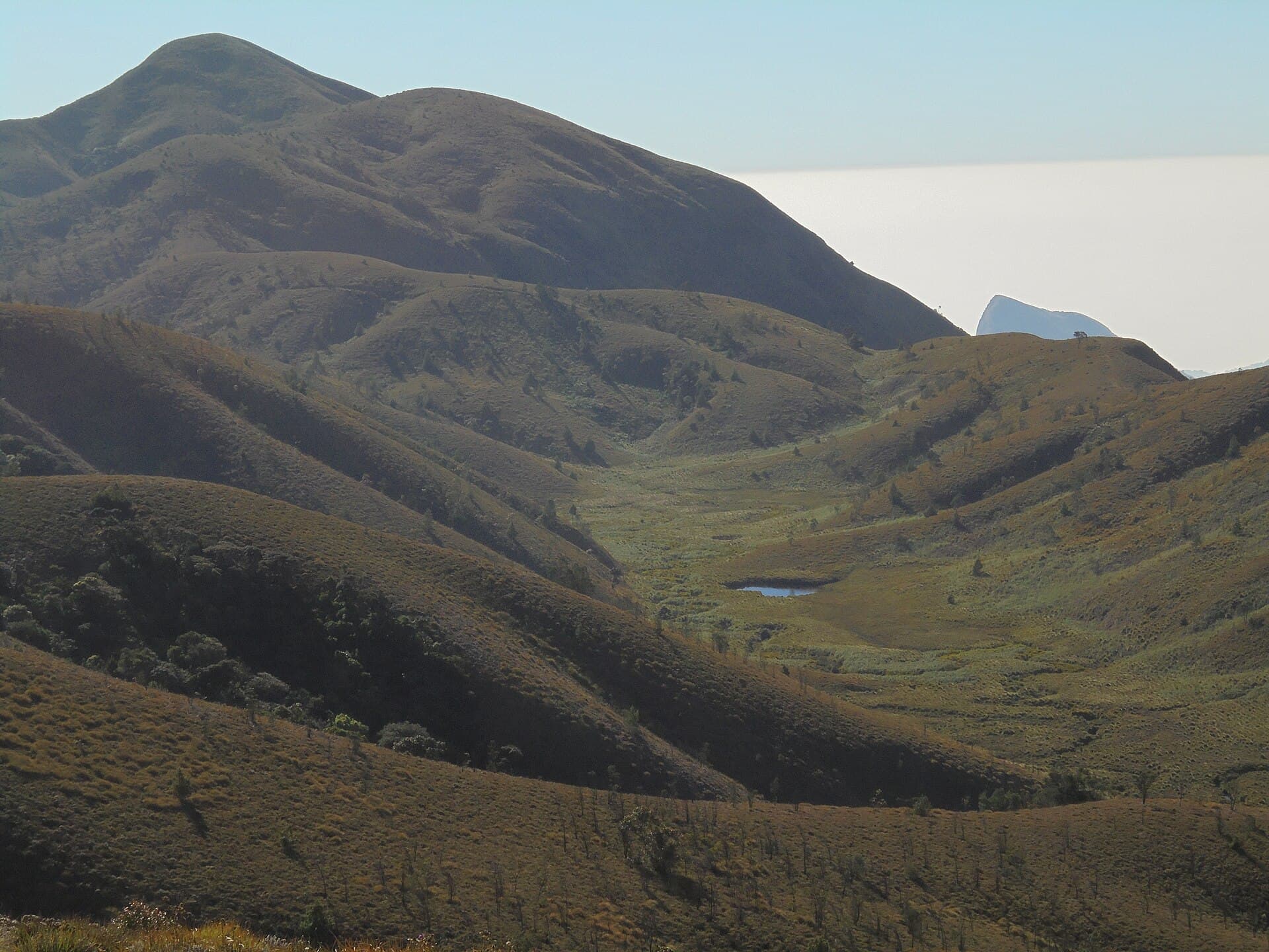
Meesapulimala
Kerala's second-highest ridge, walked at first light.
Photo: Sivakumar1605 / Wikimedia Commons (CC BY-SA 4.0)
Challenging
Difficulty
16 km
Distance
2D / 1N
Duration
2,640 m / 8,661 ft
Peak Altitude
Post-Monsoon, Winter
Best Season
Why This Trek
Meesapulimala
Meesapulimala compresses a lot of altitude into a short distance, which is exactly what makes the sunrise push worth the early wake-up - you're standing above most of the Western Ghats before the tea gardens below have caught the light. It's a proper overnight in the hills, not a day trip dressed up as one.
Before You Book
- Forest access may require a valid permit.
- Authorised guide support may be mandatory.
- Departure depends on current route availability.
- Weather and wildlife conditions may affect access.
- Route and timings can change for safety reasons.
- Camping is only offered where currently permitted.
- Government ID may be required for permit registration.
- Final confirmation is issued only after operational verification.
The Trail
From the Rhodo Valley trailhead the trail climbs through grassland and rhododendron cover to a campsite below the ridge, with the final approach to the summit saved for the next morning while the light is still soft. The connecting trail toward Kolukkumalai is currently closed to trekkers, so the route stays within the approved Rhodo Valley corridor.
- Kerala's second-highest peak, after Anamudi
- Rhododendron-lined Rhodo Valley on the approach
- Pre-dawn summit push timed for sunrise over the Anamalai and Palani hills
Itinerary
- 1
Munnar to Rhodo Valley base camp
Jeep transfer from Munnar to the Rhodo Valley trailhead, then a trek in to the base camp through grassland and rhododendron forest. Overnight camp near the campsite.
8 km · +400 m
- 2
Summit push and return to Munnar
Early start for the summit, timed for sunrise over the surrounding ranges, then a full descent back to the trailhead and jeep transfer to Munnar.
8 km · +540 m
Who Is This Trek For?
Fitness level required: high. Group size runs 6–12 people. Age range: 14–50 years.
Participants above 45 years must share a valid medical fitness certificate with our team before the trek.
Inclusions & Exclusions
- Forest permit coordination and authorised trek guide
- Jeep transfer between Munnar and the Rhodo Valley trailhead
- Camp stay, dinner, breakfast and packed trail lunch
- Trek leader and on-trail first-aid support
- Travel to and from Munnar
- Personal trekking gear (shoes, backpack, warm layers, etc.)
- Any stay in Munnar before or after the trek
What to Carry
- Trekking shoes with ankle support
- Warm layers for the overnight camp (temperatures drop sharply after dark)
- Rain cover / poncho
- Headlamp with spare batteries
- 2L water capacity
Safety
- Trek leader carries a first-aid kit and communication equipment for network-dead sections
- Group pace is set by the slowest member, not the fastest
- Weather-based rescheduling takes priority over the itinerary
- Summit push begins before sunrise - headlamps are mandatory
Permits
Meesapulimala sits on Kerala Forest Development Corporation (KFDC) land in Munnar. Treks must be organised through KFDC's approved Rhodo Valley route and booked in advance - the direct trail from Kolukkumalai is currently closed to trekkers. Always confirm current route status before booking.
Cancellation Policy
A ₹1,000 Booking Advance secures your booking request. Final confirmation is issued only after operational and permit verification. The advance is non-refundable and non-transferable, as it blocks your spot in the group.
If we cancel a trek due to weather, safety, or forest department restrictions, you get a full refund or a free reschedule.
Sustainability
Meesapulimala's grassland and shola pockets are part of a fragile high-altitude ecosystem - we keep to the approved KFDC trail and campsite rather than opening new ground.