Ballalarayana Durga
A strenuous Western Ghats trail to a ruined fort, forest and waterfall along the way.
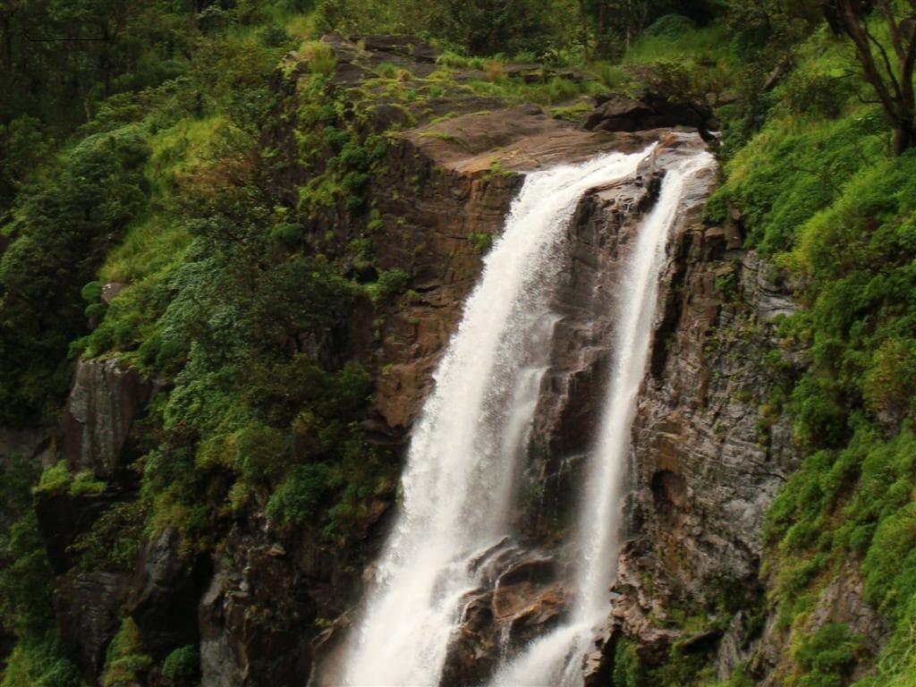
Photo: Sumesh Always / Wikimedia Commons (Public Domain)
Challenging
Difficulty
6 km
Distance
1D / 0N
Duration
1,509 m / 4,951 ft
Peak Altitude
Monsoon, Post-Monsoon
Best Season
Why This Trek
Ballalarayana Durga
This is a full day's forest climb, not a stroll to a viewpoint - close to 800m of gain over a rocky, sometimes slippery trail, with a stream crossing near a waterfall partway up. What waits at the top is a Hoysala-era fort reduced to walls and archways, and a wide, quiet view across the Western Ghats. The route is run only with forest permission and an authorised guide, because the terrain and the permit rules both call for it.
Before You Book
- Forest access may require a valid permit.
- Authorised guide support may be mandatory.
- Departure depends on current route availability.
- Weather and wildlife conditions may affect access.
- Route and timings can change for safety reasons.
- Camping is only offered where currently permitted.
- Government ID may be required for permit registration.
- Final confirmation is issued only after operational verification.
The Trail
The trail climbs from the Charmadi side through dense forest, crossing a stream near a waterfall before the final stretch steepens toward the fort ridge above 1,500m. It runs roughly 6-7 km with close to 800m of elevation gain, and the return trip - including the waterfall stop - takes 7-8 hours. The last approach to the ruins is loose underfoot, one reason this route is walked only with an authorised guide.
- A stream and waterfall crossing partway up the climb
- Hoysala-era fort ruins above 1,500m
- Wide, quiet ridge views across the Western Ghats
Itinerary
- 1
Base to fort and back
A full return walk with a break at the waterfall, operated with a forest permit and authorised guide.
6 km · +809 m
Who Is This Trek For?
Fitness level required: moderate. Group size runs 6–18 people.
What to Carry
- Trekking shoes or good grip footwear
- Rain layer
- 1.5L water capacity
Safety
- Trail can be slippery near the waterfall crossing during monsoon - trek leader assists at this point
- Authorised guide accompanies the group for the full route
Permits
Forest permission for this route is issued through the Karnataka Forest Department's Aranya Vihaara portal, with a certified guide mandatory under current forest department rules. Always confirm current access rules before booking.
Cancellation Policy
A ₹1,000 Booking Advance secures your booking request. Final confirmation is issued only after operational and permit verification. The advance is non-refundable and non-transferable, as it blocks your spot in the group.
If we cancel a trek due to weather, safety, or forest department restrictions, you get a full refund or a free reschedule.
Sustainability
Monsoon trekking here follows strict no-plastic and single-file trail rules to protect fragile wet-season undergrowth.
From the Trail
Frequently Asked Questions
Are leeches a concern?
Yes, during monsoon months - we cover leech precautions in the pre-trek briefing.
Is camping offered on this trek?
No - camping is not a standard offering here. It's operated as a day trek.